 I left my campground at Moab at around 7:00am. After stopping briefly for coffee and fuel, I followed route 191 north to route 70. The landscape grew drier and more lunar in appearance, but it was not too hot. The sun was incredibly bright however. It was so bright that I could not tell I was wearing sun glasses.
 Streets of Moab

Thirty miles west of where 191 intersects with route 70 I pulled into a town called Green River to fuel up and buy a pair of goggles with lenses as tinted as a welder’s mask. On my way out of town I saw a sign that said no services on route 70 for 106 miles. That’s the farthest stretch without gas I’ve seen so far. It hinted at how barren the landscape I was coming up on would be.
Just out of town I came upon a dramatic rock formation called the San Rafael Reef. Before this trip I had no idea the term reef could be applied to above water formations. The San Rafael Reef is an enormous barrier wall that cuts across the Utah desert for more than 20 miles. Until the mid 19th century travel from one side of the reef to the other meant either going around it or using one of the few (often secret) passes. In the 1950s a cut was made in the reef to allow a single lane of route 70 to pass through. This was later widened to the two lanes it is today.
The reef looks like a scene described in a J.R.R. Tolkien novel.

Beyond the reef is a great plateau known as the San Rafael Swell. Here the earth has been pushed up to form a great dome over 100 miles across and 8000 feet high. The top of the dome is a desert filled with unusual rock formations. Despite the distance, the ride across the swell passed quickly. The scenery was interesting and the air was much cooler than the brilliant sun and barren landscape would suggest.

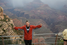
I stopped at multiple view points to explore and take pictures. During one of my stops I ran into another rider with a bike more fully loaded than mine. He, like me, was riding cross country. I never got his name, but I ran into him several times during the long day.

I descended down from the swell and fueled at a town called Salina. Outside of Salina the landscape began to change again. Soon the mountains that were barren and gray grew greener until by the time I reached route 89 south I was surrounded by deep green fields and sage colored hills not unlike what I remember seeing in the California Sierras.

I followed route 89 for 50 or 60 miles passing through numerous small farming towns that again reminded me of Northern California or even Pine Island New York. The road parallels a river and large reservoir. I remember driving through a town in western Colorado and seeing a sign that said “in the west water is life”. Nowhere is that more apparent than the desert.
I made a fuel stop at one small town only to discover my American Express card was declined. I’ve had this happen to me before. Amex monitors spending patterns and flags cards when the patterns look suspicious. I had to call American Express and explain all the small fuel charges across the country were indeed from me. The person I spoke to was nice and assured me the card would work going forward (it was denied again in Las Vegas…)
When I pulled out of the small town, much to my dismay, I felt a wobbling in my handle bars at low speeds. With a little experimentation, I narrowed the speed range when the wobble ocurs to between 20 and 30 miles per hour; no wobble below or above. The wobble really stressed me out. I immediately called the Triumph dealership in Las Vegas and made an appointment. I doubt my front wheel will fall off or anything, but I don’t want to find out at highway speeds or in some sun blasted lunar wasteland.
What's causing the wobble?

With the wobble weighing heavy on my mind, I continued my ride down to Bryce Canyon. I had never heard of Bryce Canyon before I started planning this trip. I didn’t know what to expect there, and I had contemplated skipping it. If there’s one thing I’ve learned on this trip, however, it is good things are often down the less direct road (is that Frost?). Bryce was no exception. What an awesome place.
 I entered Bryce Canyon through Red Canyon National Park. Red Canyon is a hiking park. There are no roads for touring. I stopped at a trail head and took a few pictures, but I decided not to go to deep into the canyon.
Bryce, on the other hand, has an awesome network of roads that allow you access to the spectacular viewing platforms and pathways. After paying my entrance fee, I rode out to a place called Rainbow Point. This is the highest and farthest out view point in the park.

I stopped at every viewpoint along the canyon rim. At one place there were two large crows or Ravens (Ravens sounds neater) perched together on a guard rail post. They were completely unperturbed by the presence of humans. They just sat on the post and watched us watch them. They were eerily contemplative and Poe’s poem came to mind.
Who's that rapting at my cabin door...


After I left the Ravens, I rode out to a place called Inspiration point. The viewing platform at Inspiration point reminded me of a similar spot at Rock City on Lookout Mountain in Tennessee. Of course, the view is a little different.
When I was leaving Inspiration Point, I ran into the same solo motorcycle rider I had met at various stops on route 70. We compared notes. I told him about my wobble, and he said he was experiencing the same thing in the same speed range; that seemed weird, but somehow comforting. The only thing I can figure, is the roads have somehow changed the shape of our tires.
I did a lot of hiking in Bryce that afternoon and the next morning. Bryce is amazing. It is famous for its unique rock towers called hoodoos. Having learned my lesson about riding in the deep darkness, I decided not to stay for sunset. It was a hard decision. Everyone in the visitor center was talking about how great the stargazing is at Bryce, and I’m sorry I missed it.

It took me a while to find my campground. I get lost more than any man I know. One of these days I’m going to break down and by a GPS. Of course, then I’ll miss the thrill of nearly dumping the bike while making u-turns in gravel driveways. I finally found it with plenty of sunlight to spare.
Once again I was impressed by the KOA campground I stayed at. The couple managing the site were great, and the facilities were great too. I even went swimming; something I rarely do in my pool. The pool was cold and filled with German tourist who seemed unaffected by the chilly waters. I growing increasingly convinced that KOA is the best kept secret of the retiree sect.
The next morning I rode back to Bryce early to see the sunrise. The place was full of people doing the same thing. There were hikers, RVs, rabbits, and deer everywhere. The light show created by the rising sun illuminating the hoodoos, cliffs, and arches was breathtaking.

I spent the morning hiking down to the canyon floor. My decision to leave my motorcycle boots at home in favor of a pair of Timberlines (that actually belong to my son) is proving very wise.
After I left Bryce I followed route 89 down to Zion National Park which is another truly amazing place. There I had a couple of adventures including discovering, during a particularly steep descent down a canyon road, that my back brakes are worn out and then losing my keys on a hiking path; but that’s for another blog entry.
1 comment:
Wow your desciptions are bringing back memories. Every morning Proudma asks me to see if there is anything new on your blog and I read the latest installment to her. Yesterday, I did not get a chance to respond so I will today.
You (and Frost) are right. The road less traveled often has the best sights, the best people and the greatest adventures. Still having a GPS in the backpack for when you just have to get somewhere is a comfort and is not cheating too much.
I guess the appointment at the Triumph dealership has or will stress out American Express even more and am sure you will relate the tale at some point.
I am going out to the car and pull in the (antique) road atlas. I presume that the roads are in the same place even if they don't have web addresses. You have peaked my curiosity and my desire to increase my vicarioius experience with your trip.
Proudma is following your adventures closely and your "teasers" are very effective to keep her coming back. She is thinking that she wants to see some of the things you have described, but on four wheels, preferably an RV (air conditioned, smooth ride, etc.). A word of warning though. Do not spread word of the KOA campgrounds too far or the AARP fairy will steal all your teeth some night.
Looking forward to your next post or call.
Keep the dirty side down.
Proudpa
Post a Comment