Lake Mead was created by Hoover Dam. It is the largest manmade lake in the country, and it is drying up. The desert has reclaimed most of the Lake Mead Recreation Area. The numerous scenic overlooks that once looked down on Lake Mead now look upon a dried up hole. The lake is less than 50% full. The same drought in the Rockies that weakened the pine forests and contributed to their demise by the Pine Beetles had slowed the flow of water down the Colorado River. Cities like Las Vegas draw their drinking water from Lake Mead, and they draw more and more each year.
 Leaving the disturbing sight of the desolation of the Lake Mead Recreation Area behind, I follow route 93 south as it twists and climbs. Signs appear warning drivers about security check points and declaring the dam cannot be crossed by large vehicles (trucks, buses, and RVs). The security is a legacy of 911. Prior to the attack there was almost no security at the dam. Blowing up Hoover Dam would cause untold devastation to the cities downstream not to mention the long term loss of drinking water and power for several major southwestern cities. It’s not unthinkable. There was a time when one could not imagine anything bringing the Twin Towers down.
The men who built the dam never doubted it would last forever. There’s a monument on the Lake Mead side of the dam dedicated to the cooperation of the states along the Colorado River that cooperated in building the dam. Worked into the monument is a star map that acts as a celestial calendar to be used by future civilizations to date the dam. The monument’s designer imagined the dam lasting far longer than the society that created it.
I turn a bend, and there’s the dam. It’s incredible. I pulled into the dam parking garage. I’ve become quite adept at navigating the bike in parking garages. It was once one of my biggest anxieties. I’ve encountered a surprising number of them on this trip (hanging phrase intended).

There are two different tours. One tour, the long tour, takes you through the dam and power station. The shorter tour just takes you through the power station. I was too late for the long tour so I settled for the power station tour.
An enthusiastic tour guide led a group of us down to the power station (500 feet into the dam) and cited numerous facts about the dam. For example the dam is 700 feet high and it provides enough power to run 2 million homes. He was exceedingly proud of the dam, and he lamented repeatedly how the tour had been confined to small areas in the dam since 911.


I spent a couple hours at the dam. Before I left I bought post cards at the gift shop where the cashier worked dam into every sentence she spoke. She’d say things like “I hope you liked your dam tour” or “Here’s your dam post cards”. I guess those dam jokes never get old.


The Colorado River, and the dam, are the eastern border between Nevada and Arizona. Crossing the dam into Arizona I raced the 220 miles to Flagstaff. I had a tent site reserved and I did not like the idea of having to setup in the dark.

 White band represents high water mark. The band is about 90 feet tall (ie: lake is 90 feet off full).
Route 93 intersects with route 40 in Kingman Arizona. I fueled up at Kingman and called the KOA in Flagstaff to let them know I would arrive after their office closed.
About a 140 miles west of Flagstaff I could see dark storm clouds and flashes of lightening on the horizon. I pulled over for dinner and put on my rain gear. The restaurant was filled with truckers. I spoke to one woman driver for a little while about the weather. She laughed when I told her how bad it was to be on a bike when a big rig passed in the rain. I waited at the truck stop for the storm to pass, but it never did.
I drained my 6th cup of coffee and headed out on the road. It was dark. Flagstaff at 7300 feet is 2000 feet higher than Denver. As I climbed toward it the air grew colder. I stopped for fuel early and put on another layer of clothes.
It started to rain and I had a tough time seeing. Numerous signs warned of crossing elk and deer (they actually have separate picture/symbols for elk and deer). It was one of the few times I can remember when I welcomed a semi tail gating me. The trucks head lights did a much better job of illuminating the road in front of me than my bike’s lights.
The rain and cold slowed me down. I stopped again for coffee to warm up. I did not reach my camp site until after midnight. Setting up the tent in the dark proved easier than I imagined. When I was equipping for the trip, I purchased a bright LED light that strapped around my head like a miner’s lamp. It illuminated everything in front of me. It was one of my wiser purchase.
The rain had slowed to a drizzle and I was able to setup without getting too wet. I’ve used my rain gear on this trip much more than I thought I would.
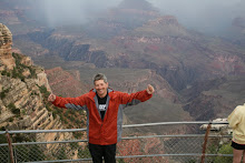
It was cold. I almost missed the desert. I crawled into my sleeping bag. Tomorrow I was going to the Grand Canyon.
2 comments:
I hope u enjoy the grand canyon! Please be careful!!
Love u!
-Austyn
Dan - I had the chance to catch up on your blog over the holiday weekend. I have really enjoyed your insight to these great sites. I saw the same places on a tour with my family in May. They are just awe inspiring vistas and I appreciate re-living them through your perspective. I am not a motorcycle enthusiast such as yourself, but you don't have to be to enjoy your writing of your experiences. Good Luck and Safe Roads Ahead!
Tom Hornick
Post a Comment